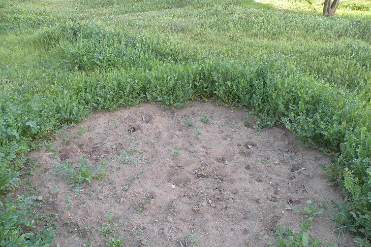
For a year and a half, I’ve been experiencing the soil in this yard — digging in it, crumbling it in hand to check the moisture level, watching rain infiltrate — but only just now have I discovered what experts in soil, soil scientists, have to say about it.
I located my patch of the Earth’s crust on the Web Soil Survey provided by the National Resources Conservation Service, part of the United States Department of Agriculture. Their report gave articulation to many things I’d already experienced first hand, and it also surprised me in a couple of areas.
The survey calls the soil in my yard “Fallbrook rocky sandy loam, 5 to 9 percent slopes.” It describes this soil as “well drained” even though it has a layer of “paralithic,” or weathered, bedrock at 20 to 40 inches down. The layer of bedrock is granodiorite, and it has a “moderately high to high” capacity to transmit water, at 0.57 to 1.98 inches per hour. This aligns with the fact that I’ve never seen a pond form anywhere in the yard, even during the heaviest of rains.
Though my soil is well drained, it also has “moderate” available water storage in its profile. (I suppose that’s what you’d expect for a soil with loam in its texture.) This has consequences for how frequently I need to irrigate: less frequently than a sandy soil and more frequently than a clay soil. Last summer, my vegetables could go three to five days between waterings, and my one year-old apricot and nectarine trees could go 10 to 14 days between waterings.
The report gives a typical profile for my soil as follows: 0-6 inches, sandy loam; 6-24 inches, sandy loam or sandy clay loam or loam; and 24-32 inches, weathered granodiorite bedrock. But I’ve noticed while digging that I can almost always go deeper than 24 inches without encountering the bedrock, and I believe that’s because I’ve been digging and planting on the down slope of where the house was built so it’s likely the soil there was piled up when the house foundation was being excavated.
A surprise was that the report considers my soil not “prime farmland.” I wondered what wasn’t prime about it. My first guess was the depth, and that seems to be accurate, as I compared my soil to soil considered “prime farmland” in the Sacramento Valley and that soil is more than 80 inches deep. It’s also a silty clay loam that has “high” water storage capacity.
My soil is nonetheless declared by the report to be suitable for commercial farming of avocados, citrus, and “truck crops” (vegetables). Hear that? Suitable for avocados, officially. That’s all I need to hear.
At the same time, I guess that means that if my avocado trees aren’t doing well, then the fault is all mine.


Interesting and reassuring:)
hello Greg, any chance you’d have time to do a post on HOW to access data for our home location on the Web Soil Survey? I spent a few minutes clicking around and everything I pulled up on my area was incomprehensible. Thank you!
I love reading about and thinking about soil. I bought, at a library used book sale, the collection of USDA yearbooks of Dan Aldrich, soil scientist and UC Irvine’s first Chancellor. Your soil sounds perfect for avocados, which have a love/hate relationship with water. “Give me a drink, hey, don’t drown my roots!” Having a fine silt that behaves like clay, my big avocado watering secret is not to water them!
Love/hate relationship with water. That’s a great way to put it. I’m going to steal that.
That collection sounds like something I would enjoy reading too. I’ve found that a lot of the older stuff is actually better than the newer stuff.
For example, as regards root rot in avocados, the farmers and scientists before about 1945 saw that it was a disease induced by soggy soil. Period. “Poor drainage-itis” was the nickname that George Zentmyer of UC Riverside gave the disease initially.
But later research became obsessed with a microbe, Phytophthora cinnamomi, that was sometimes found on roots that were diseased. As if that was the cause and the enemy. To this day, research is funded for new chemicals to kill the microbe. Orondis is the latest one being used.
But the chemicals don’t stop avocado trees from declining with rotting roots if they’re in soggy soil. I’ve seen this firsthand on a number of farms.
The farmers and scientists of pre-1945 were still the most correct.